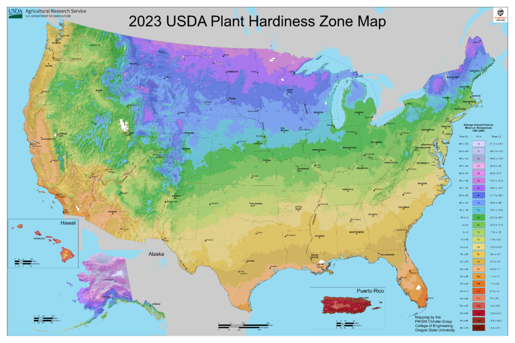
What are Zone Maps?
The USDA Hardiness Zone Map divides North America into 11 separate planting zones. Each zone growing is ten degrees warmer (or colder) in an average winter than the adjacent zone. If you see a hardiness zone in a gardening catalog or plant description, chances are it refers to the USDA map.
Gardeners need a way to compare their garden climates with the climate where a plant is known to grow well. That’s why climate zone maps were created. Zone maps are tools that show where various permanent landscape plants can adapt. If you want a shrub, perennial, or tree to survive and grow year after year, the plant must tolerate year-round conditions in your area, such as the lowest and highest temperatures and the amount and distribution of rainfall.

Please fill out the form below and we will get back with you ASAP.